December 8, 2005
The Nautical Mile
All of the journal pages I have produced so far have a reference at the beginning as to the geographic location of the boat and crew. These locations are stated in a series of numbers and letters and have been changing as we move west. These references are called latitude and longitude coordinates. We are acquiring these coordinates with GPS equipment on board. The following graphs will explain this process a little better:

Almost all maps and charts are designed so that north is at the top, south at the bottom, east on the right, and west on the left. In addition, maps and charts show latitude and longitude, a system of geometrical coordinates that provides a simple way to identify location. Midway between the poles, the equator, a great circle, divides the earth into northern and southern hemispheres. Parallel to the equator and north and south of it are a succession of imaginary circles that become smaller and smaller the closer they are to the poles. This series of east-west-running circles, known as the parallels of latitude, is crossed at right angles by a series of half-circles extending north and south from one pole to the other, called the meridians of longitude.
Navigators express their north-south position using parallels of latitude—lines running across a map, chart, or globe from left to right (west to east). A latitude coordinate indicates distance from the equator; an imaginary line equidistant from the poles that encircles the middle of the globe, dividing it into the northern and southern hemispheres. Navigators express their east-west position with meridians of longitude, lines running from top to bottom (north to south) on a map, chart, or globe. A longitude coordinate indicates distance from the prime meridian, an arbitrarily selected line from which all of the others are measured which runs through Greenwich, England, near London. Unlike lines of latitude, which become progressively shorter as they near the poles, all of the lines of longitude are the same length. Any location on the globe can be described in terms of its angular distance from the reference points. Maps are usually arranged so that true north is at the top of the sheet, and are provided with a compass rose or some other indication of magnetic variation.
Navigators express distance in terms of degrees (usually indicated by the symbol °). Parallels of latitude north of the equator, which lies at 0°, are identified as north, and those south of the equator are identified as south. The North Pole lies at latitude 90° north, the South Pole, at latitude 90° south. By international agreement, the prime meridian lies at 0° longitude. Meridians of longitude east of the prime meridian are designated as east, and those west of the prime meridian are identified as west. On maps, the designations are abbreviated as N, S, E, and W.
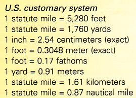
Each degree of latitude and longitude is divided into 60 minutes, and each minute is further divided into 60 seconds. Navigators measure distance in nautical miles, an internationally agreed-on standard equaling the average length of one minute of one degree, or 1,852 m (6,076 ft).

Like street addresses, position coordinates identify the latitude and longitude lines that intersect at a particular location. Houston, Texas, for example, is located at latitude 29°46' north, longitude 95°22' west, and Nairobi, Kenya, at latitude 1°17' south, longitude 36°49' east. Latitude and longitude prove particularly useful in describing locations in the middle of the ocean. On April 14, 1912 the ocean liner Titanic struck an iceberg in the northern Atlantic Ocean at latitude 41°33' north, longitude 50°01' west.


The relationship between longitude and time is also an important tool for navigators. Time is derived from the position of the Sun, as it appears to move from east to west across the sky. Noon occurs when the Sun reaches its highest point in the sky—that is, the moment when the Sun has completed its rise but has not yet started to set. By international agreement, the time of day at the prime meridian (0°), called Greenwich mean time (GMT), sets the standard for the rest of the world. The Sun moves 15° each hour, making the time one hour earlier every 15° west of the prime meridian (see Time Zone). When it is 3 pm at Greenwich (longitude 0°), at longitude 75° west (near New York City) the time is five hours earlier (10 am), and at longitude 120° west (near Los Angeles, California) it is eight hours earlier (7 am). Where longitude 180° west meets longitude 180° east in the Pacific Ocean is the International Date Line. There, the date changes by one day. When it is 10 am Monday on the east side of the International Date Line, it is 10 am on Tuesday on the west side of the line.


Although the equator was an obvious choice as the prime parallel, being the largest, no one meridian was uniquely qualified as prime. Until a single prime meridian could be agreed upon, each nation was free to choose its own, with the result that many 19th-century maps of the world lacked a standardized grid. The problem was resolved in 1884, when an international prime meridian, passing through London's Greenwich Observatory, was officially designated. A metallic marker there indicates its exact location.
Degrees of latitude are equally spaced, but the slight flattening at the poles causes the length of a degree of latitude to vary from 110.57 km (68.70 mi) at the equator to 111.70 km (69.41 mi) at the poles. At the equator, meridians of longitude 1 degree apart are separated by a distance of 111.32 km (69.17 mi); at the poles, meridians converge. Each degree of latitude and longitude is divided into 60 minutes, and each minute divided into 60 seconds, thereby allowing the assignment of a precise numerical location to any place on earth.
No comments:
Post a Comment